If you’re coming to Aruba, you’ve probably already seen some of the main places people take photos on the island. There are a lot of spots that look good on camera, but not everything is just a photo stop. Many of these places are part of the island’s history or shaped by how Aruba developed over time. So while you’re taking your pictures, take a moment to look at where you are. Respect it and be aware of it. Every place has a story.
Here are 5 spots around the island where you can take photos while also understanding what you’re looking at.
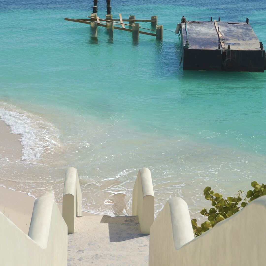
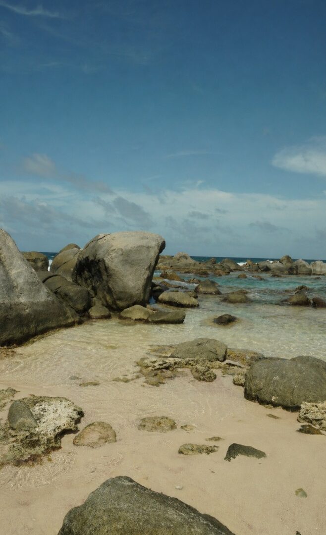
Rodgers Beach
At Rodgers Beach, there’s a set of stairs that lead straight down to the beach and clear blue water. People usually stop here for photos because of how the stairs line up with the ocean behind them
But the name Rodgers Beach comes from something else. The beach is named after Captain Robert Rodgers, who was involved in developing the oil refinery in San Nicolas, which played a big role in Aruba’s growth. So while most people come here for the stairs and the view, the area itself is tied to an important part of the island’s history.
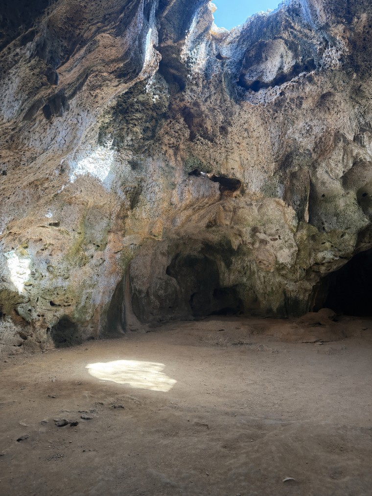
Quadirikiri Cave
Inside Quadirikiri Cave, the light is what stands out. There are openings in the ceiling that let sunlight come through, lighting up parts of the cave floor and walls. It creates a natural contrast that makes photos look strong
But the cave itself goes back much further. It’s located in Arikok National Park and formed out of limestone over time. On the walls, you can still find markings from the island’s early inhabitants, the Arawak people, and the name “Quadirikiri” comes from their language.
It’s important to leave these as they are. Don’t touch the drawings or write on the walls. It’s part of the island’s history and it should be respected.
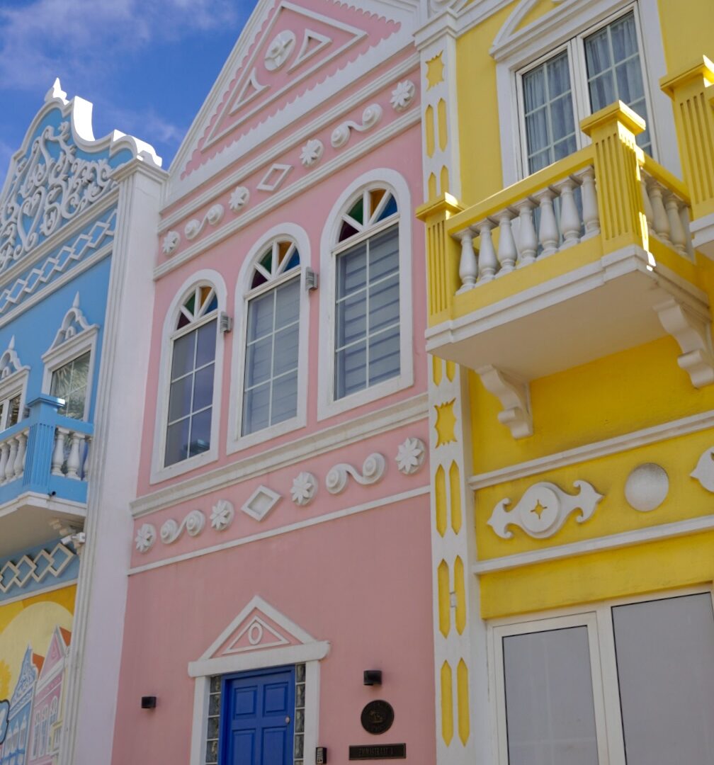
Wilhelminastraat
Wilhelminastraat is a street in Oranjestad with rows of colorful buildings. You’ll see different colors, mostly bright ones, all next to each other. It stands out right away when you walk through.
But this street is also one of the oldest parts of Oranjestad. It was one of the main roads that connected the harbor to other parts of the island, and over time it became an important area for daily life and trade.
The buildings you see today are influenced by Dutch colonial architecture, mixed with Caribbean style and colors, which is a big part of Aruba’s identity
Northshore Volcanic Rock
On the north side of the island, closer to the lighthouse, the coastline looks completely different. You’ll see dark rock along the shore with waves hitting hard against it. It’s not like the calm beaches on the west side. This area is part of Aruba’s older landscape. The north coast is rough because it faces the open sea, with strong waves constantly hitting the rock over time.
That’s also why the water here is not for swimming. If the waves are reaching you, you’re too close. Don’t stand with your back to the water and keep your distance.
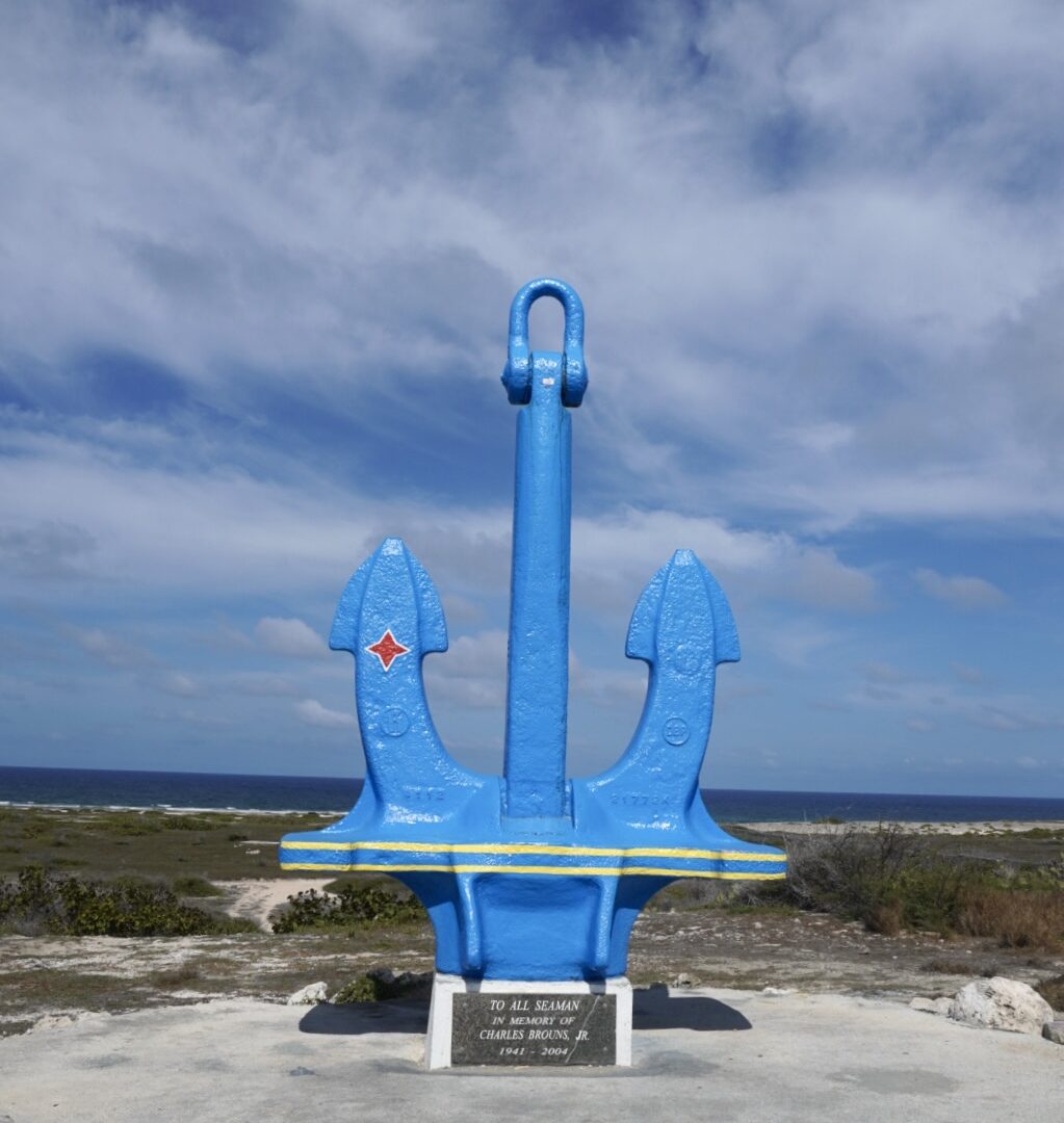
The Anchor
There’s a large anchor placed along the coast with the ocean behind it. It’s an easy stop for a photo. The shape and color stand out right away. The anchor used to be painted bright red so it would stand out clearly against the sea. Right now it’s temporarily painted in the colors of the Aruba flag. This was done to celebrate Status Aparte and is likely temporary. It was placed here in 1985 as a memorial for seamen who lost their lives at sea. It also connects to the history of San Nicolas and the time when the oil refinery was active.
Questions with Fantasy
Where can I take nice pictures in Aruba?
All around the island. Beaches, caves, and colorful streets are some of the best options.
Where can I take unique photos in Aruba?
Try caves, the north coast, and less crowded areas outside the main beaches.
Can you visit multiple photo spots in one day in Aruba?
Yes. The island is small, so you can see different locations in one day.
What should I know before taking pictures in Aruba?
Some places have history, so don’t touch or damage anything.